Blessington Track
South Arm
(last walked 27 February 2019)


Jetty Road


Those guerilla knitters have been here!


Looking down on the platform of Permian Mudstone.


And Sooty Oystercatcher.

The path has been upgraded since last time we were here.

Cape Deliverance and Fort Direction in the distance.

(last walked 27 February 2019)
Meeting at South Arm for an interesting walk along the top of the cliffs to Fort Beach, past Fort Direction and then along Pot Beach, with views across to The Alum Cliffs and Cape Queen Elizabeth as well as a closer look at the Iron Pot Lighthouse.


Jetty Road


Those guerilla knitters have been here!


Looking down on the platform of Permian Mudstone.


With Cormorant and showing the circular holes created as minerals within the mudstone weather away at different rates and cause sinkholes.

And Sooty Oystercatcher.

The path has been upgraded since last time we were here.

Cape Deliverance and Fort Direction in the distance.


Descending to Fort Beach


Close up of the mudstone,


Lolly break


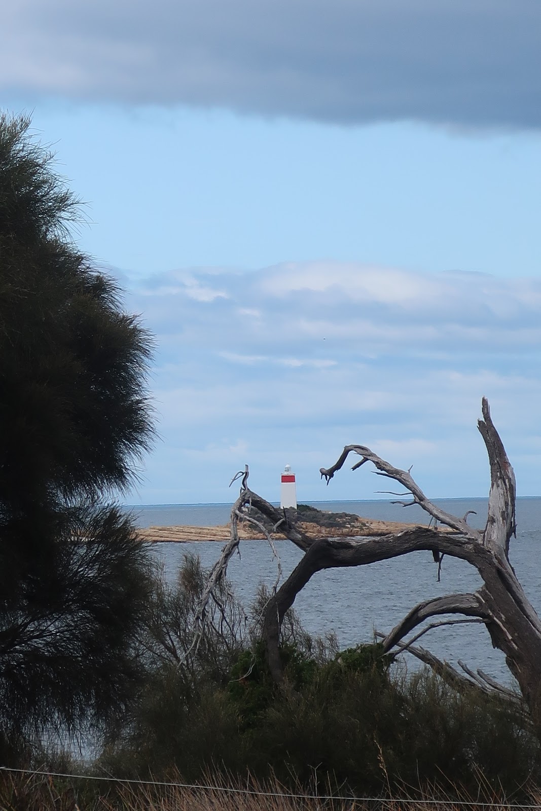
Iron Pot. The first lighthouse in Tasmania and the second in Australia. The first to use a locally made optic and it became the first to use solar power. It marks the entrance to Derwent River.


The end point of today's walk, on a rock platform

Retracing our steps to return

As sea water sprays onto warm mudstone the salt crystallises and erodes these holes and pits .

Lovely clear rock pools, but no exciting wildlife today.


Air BnB?


The memorial at Fort Direction. This site has a long and varied history as cannon emplacement, training camp and munitions store.
(More information http://southarmrsla.customer.netspace.net.au/fortdirection.htm)


The return continues


Some sculpture on the return walk

Mm! Not sure how this crept in.

There were 17 Ramblers and lunch was at Touch of the Mo at South Arm
The Renkon Chips (Lotus root) were delicious

Map
We went further than this, to the end of the beach.
